Canada

Forks of the Credit Provincial Park in Caledon

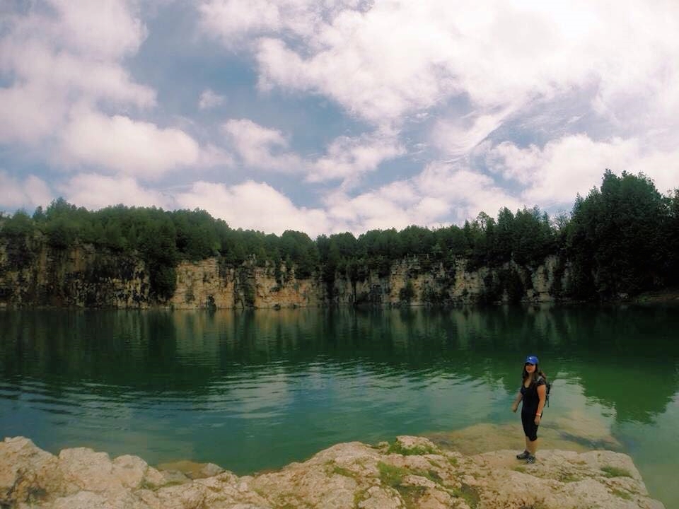
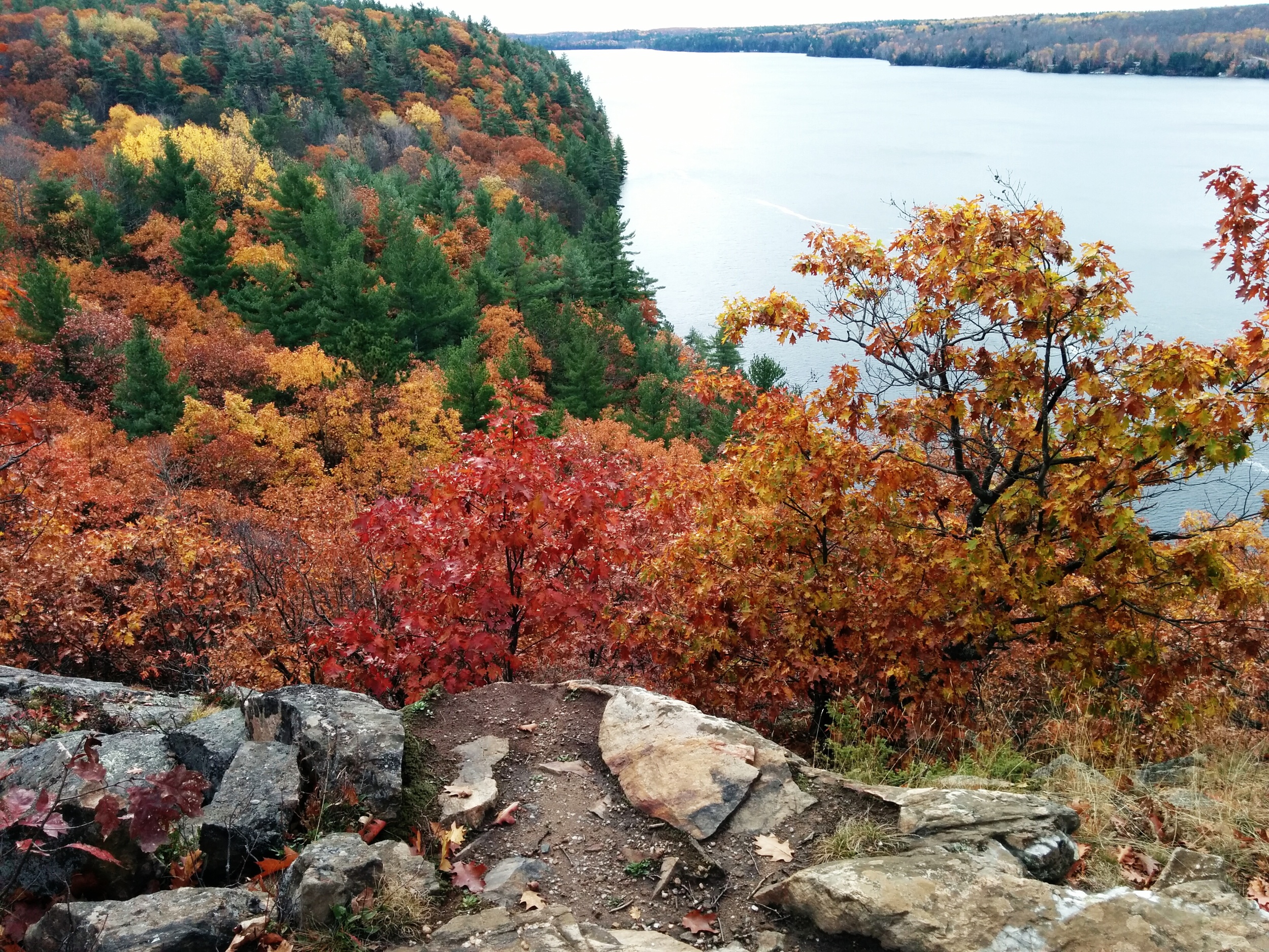
If you're up a a hike just north of Toronto, you should check out Forks of the Credit Provincial Park in Caledon. It's a beautiful park with relatively challenging trails because of the rolling hills. It's the perfect place to visit all-year round!

What we did: 

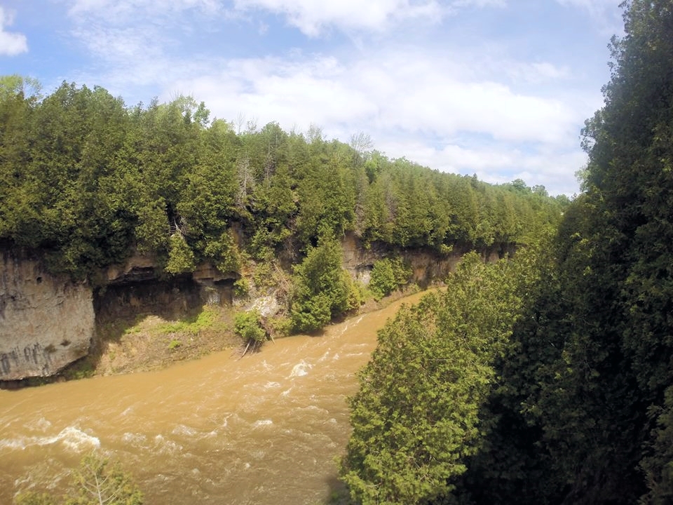
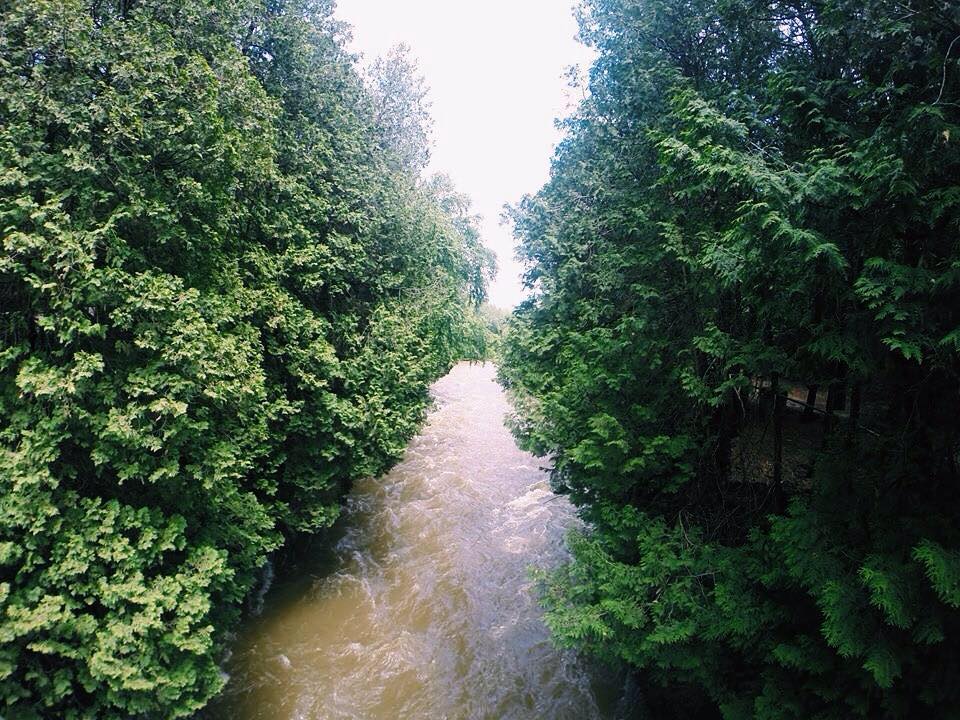
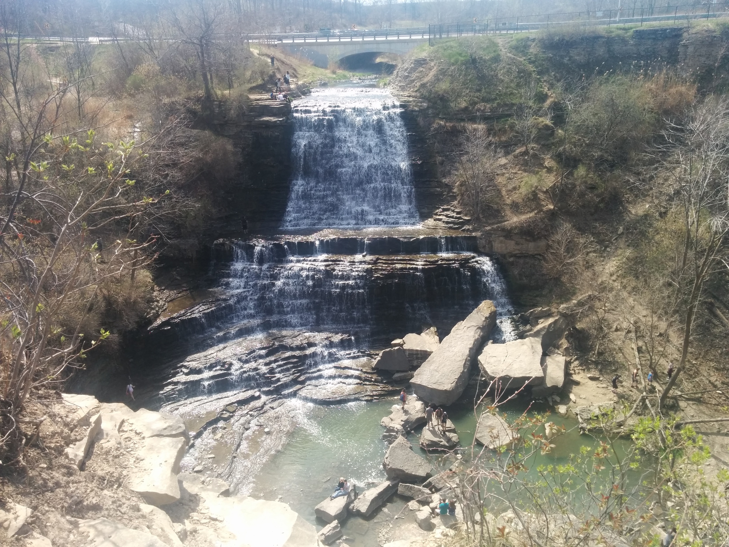
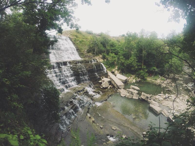
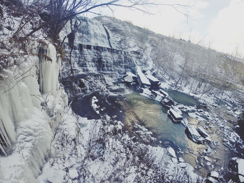
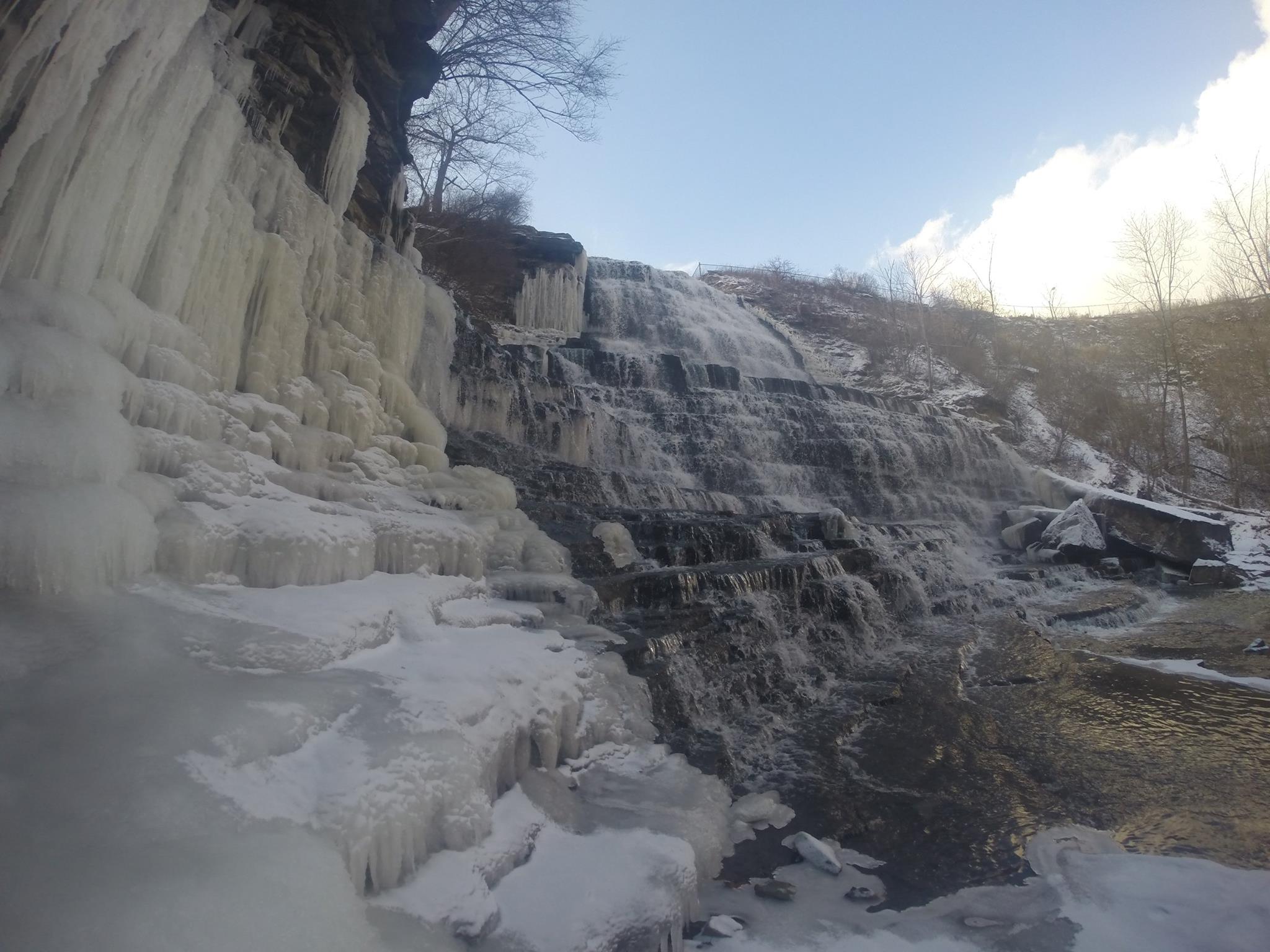
Since we were in the mood to see a waterfall, we ended up hiking the trail to Cataract Falls. There are trail markers throughout that will have a panel pointing to the "Falls." Just follow them and you should be fine. On the way back, the panel will say "Parking Lot."

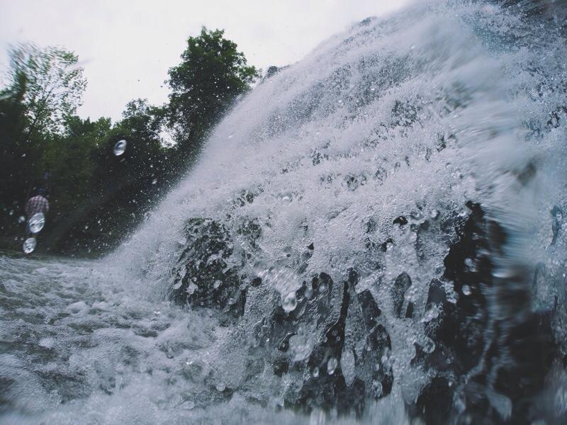
There are many hills throughout the trail, but it's not too bad. I definitely felt the burn while hiking up the hills. Otherwise, the trails are well-kept and are of moderate difficulty. Once you reach the waterfall, there's a few lookouts where you can take photos. You won't be able to get anywhere near the falls since the area is completely blocked off. But you should be able to see it just fine from the lookout. 

It took us about 1.5 hours total reach the waterfall and make it back to the parking lot.  


NOTES:

  • Location: 17760 McLaren Road, Caledon, ON L7K 2H8
  • Parking fee: There's no entrance fee, but there's a parking fee. Apparently the machine gives the option for 2 hours, 4 hours or the whole day. But when I tried to pay it only gave me the option for the full day. Or maybe I don't know how to use the machine properly. 
  • Trails: You can find the Bruce trail, Dominion trail, Kettle trail, Meadow trail, Ruins trail and Trans Canada trail here. 
  • Difficulty: Moderate - The trails are well-kept but there are a few hills to conquer. 
  • Time: This is entirely up to you. There are so many hiking trails that you can spend just a few hours or a whole day there.
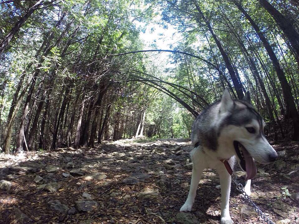
  • Dogs: Dogs are allowed but you must keep them leashed. 
  • Horses: Horseback riding is permitted on the Trans Canada trail only.
  • Activities: You can also fish here or go cross-country skiing and snowshoeing in the winter. In the summer, spring and fall, you can also hang out in the picnic area. 
  • As a heads up, it can get pretty crowded here. We went on a Sunday afternoon on a gloomy day and the parking lot was packed!

Happy Adventuring! 

Elora Quarry and Elora Gorge Conservation Area

Elora Quarry Conservation Area

Peering over the fence at the top of the parking lot, the bluish green quarry offers a stunning view. Encircled by sheer cliffs up to 12 metres high, a large beach area with easy access to the water and a sandy area perfect for sunbathers, this swimming hole is ideal for a hot summer day. Unfortunately, due to insurance regulations, you cannot jump or dive from the cliffs. The beach is also not patrolled, so make sure you keep a close watch on children at all times. 

Head down the the quarry by following the road path and trail. This short walk will take you straight to the beach. If you're feeling adventurous, feel free to hike and explore around the quarry. 

Bring a cooler, towel and swim suit for a day swimming at the quarry!

Elora Gorge Conservation Area

As a popular tourist attraction, Elora Gorge is one of the most beautiful and spectacular natural areas in the Grand River valley. With 22 metre high cliffs, riverside trails and scenic lookouts to the gorge, this park provides hikers with gorgeous views of the water below where kayakers and tubers make their way through the rapids.  

From the parking lot, we headed to the trail. If you head right, you'll reach a lookout on top of the gorge and then a dead end. If you head left, you'll reach two lookouts to see the gorge from the bottom. We kept following the trail until we reached the bridge to see the other side of the river before heading back.  

Along the way, please note that there are tons of warning signs throughout the conservation area regarding safety. Make sure you stay away from the edge of the gorge. 

Mickey's Grill and Ice Cream Parlour

If you're craving a cold treat, head to Mickey's Grill and Ice Cream Parlour in the town. There are so many flavours of ice cream and they have treats for your dog! 

Notes:

  • Entrance fee: $6/person. You only have to pay it once if you want to visit both parks. 
  • Elora is located about 25km from Guelph, Ontario through Highway 6
  • No dogs, diving or jumping allowed at Elora Quarry Conservation Area. There are washrooms and change rooms available at the park. You can also rent a life jacket.
  • Elora Gorge Conservation Area offers tubing if conditions are good. It also offers camping, canoeing, fishing, cycling, picnicking and a splash pad. 

Happy Adventuring! 

A Day at Scarborough Bluffs

For spectacular views of the escarpment and Lake Ontario, Scarborough Bluffs are a significant geological feature in North America. These towering white cliffs stretch 15 kilometres along Toronto's Eastern waterfront. At their highest, the bluffs rise 65 metres above the coastline, offering an impressive view. The bluffs are a fantastic place to visit if you're looking for a nice day out with your family, friends or canine companion. 

Let's Get Started! 

Located in East Toronto, Scarborough Bluffs can be found at the foot of Brimley Road. For a gorgeous view overlooking Lake Ontario, drive up to the top of the Bluffs and park the side of the road. 

From the parking lot at the bottom of the Bluffs, you can take the walking trail that takes you through the park and some of the naturalized areas between the cliffs and the park. 

If you're heading there during the summer months, head to Bluffer's Beach - the most beautiful beach in Toronto. Let the sun shine and wind blow in your hair as you dip your toes in the water. Don't worry, the water quality is better than the other beaches in Toronto. 

Notes:

  • With the erosion of bluffs at 1 metre per year, keep in mind that the ground can be unstable.
  • The park also offers trails, beaches, gardens, sports and recreation facilities and amenities.
  • Head there in the winter to see the frozen shoreline! 

Happy Adventuring! 

Devil's Punch Bowl Falls in Hamilton

Devil's Punch Bowl Falls is a unique waterfall located on the Niagara Escarpment in Stoney Creek, Ontario. Known for its distinctive horseshoe multi-coloured cliff, it offers an absolutely breathtaking view.

Let's get started! 

Before you start the hike, you can explore the area to see the view of the falls from the top. You'll also see a 10-metre high cross that overlooks the community. 

When you're ready, head towards the bench where you'll see a side trail marker. The trail will take you down a zig-zag path down a steep incline until you reach the bottom of the escarpment. Turn left and continue following the trail. Along the way, you'll find wooden stairs that take you down towards the river. 

From here, the goal is to take the main trail upstream until you reach the Lower Falls. There's a bunch of side trails that will take you on more difficult paths that I probably wouldn't try again. Climb up past the Lower Falls and keep following the trail. When you get closer to Devil's Punch Bowl Falls, follow the trails that are closer to the river because I noticed that some trails head uphill and away from the falls. 

You'll reach a point where the trail leads you down to the river. Use the tree roots to climb down onto the riverbed. Now head upstream towards Devil's Punch Bowl Falls and you'll be rewarded with an amazing view of the falls.

NOTES: 

  • The hike takes about 30 min - 1 hour depending how fast you move. 
  • There's a free parking lot at Ridge Road west of Centennial Parkway S. 
  • This hike is ideal during dryer weather because you'll need to hike along the riverbed to make it to the falls. If the water flow is too heavy, you won't be able to reach it. Also, mud makes everything slippery, especially the beginning of the hike. 
  • Be careful on the hike because some parts have a narrow path with a cliff beside it. 
  • Try going in the winter to see a frozen waterfall!

Happy Adventuring! 

Fall Colours at Bon Echo

Fall Colours at Bon Echo

It's only during the fall when leaves paint the forest in an array of gorgeous colours. It's one of the most beautiful times to go hiking. 

We wanted to take advantage of that, so we headed out to Bon Echo Provincial Park for the day to enjoy the lovely coloured trees.  Located in Cloyne, Ontario, the park features over 260 pictographs painted on Marzinaw Rock. The only way to access them is either canoe over or take the boat tour.  Unfortunately, the boat tour wasn't running when I went and it was too cold and windy to canoe over. 
 

Albion Falls in Hamilton

For it's staggered steps, beautiful cascade effect and rocks spread throughout the river, Albion Falls is my favourite waterfall. On a beautiful day, grab a friend, date or canine companion for this hike! 

Let's get started! 

From the parking lot further from the waterfall, head towards the trail. The trail will lead you down a hill where there will be a fork, turn left here and hike towards the river.

Follow the trail upstream until you reach the waterfall. Once you get there, use the rocks as stepping stones to cross the river. As a heads up, some of the rocks are unstable. I've slipped and fell in a few times before. 

If you're on the right side of the falls, head up to relax on the large rocks and enjoy the view. If you're feeling adventurous, follow the path to the second level of the falls. Take off your shoes and head into the water to cool off. Although, it can get pretty slippery because of the algae in the water. 

Once you're back at the bottom, feel free to navigate yourself on the rocks to get around. Some of the larger rocks have fossilized fauna and shells on it. 

When you're ready to leave, head to the left side of the falls. Head up the trail and up the stairs to get back to the road. Follow the road back to the parking lot. 

Directions:

Exit on Stonechurch Road from Red Hill Valley Parkway. Turn right onto Stonechurch Rd. and then turn right onto Pritchard Rd. When you reach Mud St., there will be parking lots on either side. I usually turn left and park at the lot further from the falls. That's where the hiking trail is. 

NOTES:

  • There's two free parking lots: One closer to the falls and one closer to the trails. 
  • The trail is a bit more challenging because you'll need to climb over fallen trees and rocks.
  • The hike takes about 30 minutes - 1 hour. 
  • If you don't feel like hiking, but still want to check out the falls. Park at the lot closer to the falls and follow the short trail downhill towards the falls. You'll still get the same awesome view of the falls. 
  • The trail can get pretty muddy and slippery during the spring or after a big rainfall. 
  • Check out the falls in the winter! 

EDIT - 2017: 

  • The trails are now closed off. You can only see the falls from the top. 

Happy Adventuring! 

From Rattlesnake Point to Crawford Lake

From Rattlesnake Point to Crawford Lake

Located in Milton, Ontario, Canada, Rattlesnake Point is an eco-tourism area owned by Halton Conservation. The top of the limestone cliffs offers a beautiful view overlooking Lowville Valley. The area offers excellent hiking trails, rock-climbing sites and camping sites. 

We hiked from Rattlesnake Point to Crawford Lake. The trail is about 15 kilometres and took us 4-5 hours roundtrip with a few breaks in-between for pictures and lunch. With the rolling hills, steep ascents and rocks everywhere, this as an intermediate hike.